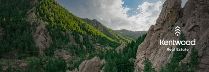
Trekking Our Natural Meadowlands
04 Aug 2023
Words and photos by Matt Maenpaa
With natural beauty everywhere you turn in Boulder County, getting out to explore can be a daunting task for residents and visitors alike. Hundreds of miles of trails weave throughout the county’s 740-square-mile footprint—where to even begin?
These trails offer a mix of scenery, difficulty and popularity and span across the county and nearby environs. They’ll take you through scenic ponds and rich forests and offer glimpses of Colorado history, majestic mountain meadows and gushing creeks.
Pella Crossing
More of a nature walk than a true hike, Pella Crossing is a series of ponds connected by almost three miles of wide, flat trails. It’s the perfect place for warming up or cooling down from bigger treks, and it’s level enough to bring folks from out of town who haven’t yet adjusted to the altitude. Nestled at the edge of the foothills, the ponds offer stellar views of the mountains, spectacular sunsets and plenty of opportunities for birdwatching.
There is a pastoral beauty surrounding the area that lends itself to a small escape from urban life. The ponds teem with life, immersing visitors in birdsong and the chirp of insects. The occasional white pelican can be seen floating on the waters alongside more common waterfowl, while the western section hosts a few raptor nests tucked in the branches of cottonwood trees. In early spring, great blue herons build nests nearby and can be seen fishing in the ponds.
Pella Crossing Trailhead, Boulder County Open Space, 11600 N 75th Street, Longmont, CO 80503

Ceran St. Vrain
This gentle 3.9-mile out-and-back trail meanders east alongside the South St. Vrain Creek, a rare trail in the Front Range that is consistently shaded and breezy in the warmer months. The trail itself is gentle, spotted with wildflowers and lined with mossy rocks that evoke the Pacific Northwest during the richness of spring. Aspens shiver among the pines, promising deep hues when the leaves turn in autumn.
The ease of the trail makes it a perfect place to wander with children, while the lack of serious elevation gain makes it another ideal hike for out-of-state visitors looking for natural wonder without the altitude sickness.
The thick forest does mean there aren’t many eye-catching vistas, but bold hikers can follow the trail until it connects with the service road to Miller Rock. From there, the ascent gets rough and rocky, but a solid scramble offers views of Longs Peak and the sprawl of the Front Range.
Ceran Saint Vrain Trailhead, Ceran Saint Vrain/Riverside Lane, Ward, CO 80481
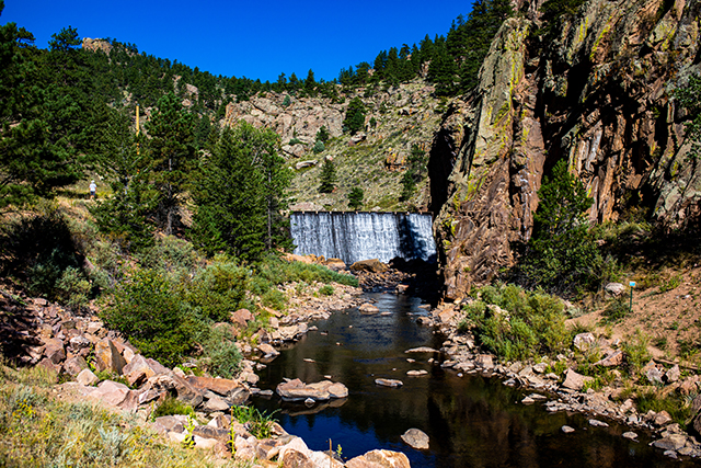
Button Rock Preserve
Tucked in the foothills outside of Lyons, Button Rock Preserve follows the path of the North St. Vrain Creek as it travels from Ralph Price and Longmont Reservoirs. From the parking lot, the service road continues for nearly two miles, past Chimney Rock Dam up to Button Rock Dam itself. The spillway for the dam is a sight to behold, as a fierce jet of water erupts through the pipes to feed the creek from the reservoir above.
While the service road along the creek is wide and easy, the nearby three-mile Sleepy Lion trail veers up into the hills to follow along meadow paths and twisted pine trees. In the spring and early summer, wildflower blooms brighten the trail, but shade is at a minimum. Rocky outcrops open to stunning views of the reservoir below, with Longs Peak, Mt. Meeker and the Twin Sisters visible on the horizon.
The trail loops back down to the base of Button Rock Dam, where a series of switchbacks lead hikers up alongside the dam to the gorgeous Ralph Price Reservoir. A few trails lead around the water as well, making for a tranquil picnic spot before heading back to the parking lot.
Button Rock Trailhead, CO Hwy 80/Longmont Dam Road, Lyons, CO 80540
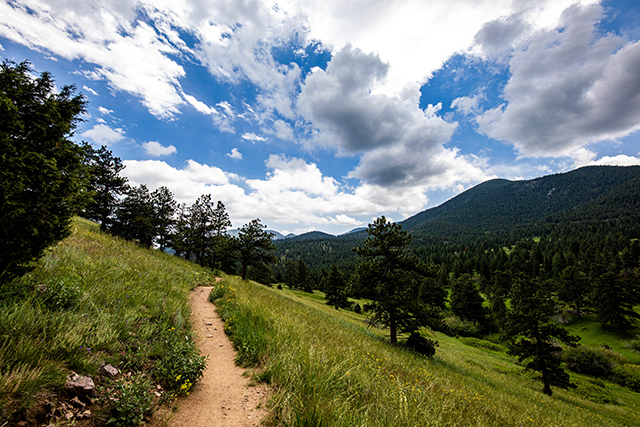
Walker Ranch Loop
One of the more rugged but rewarding trails, Walker Ranch Loop is a fierce 7.9-mile loop around the southwestern section of Boulder County. From the trailhead, the path diverges north or south. Both directions descend toward South Boulder Creek, with the southern route starting with a short climb before descending steadily into a steep section of the canyon known as “The Wall.” Not for the faint of heart, the 500-foot section of trail has hikers climb up slick stone steps while the creek rushes alongside them.
Rising out of The Wall, the trail continues to ascend steadily through pine forests until spilling out into wide meadows with stunning eastern views. Eventually, it turns back northwest for views of Gross Dam Reservoir near Nederland and a few glimpses of snow-capped Rocky Mountains in the distance.
Headed back toward the trailhead, the descent is somewhat less steep as the path returns to the creek at a much wider section. Before the last climb toward the parking lot, a picnic area with a few amenities invites rest and an opportunity to soak sore feet in the cool water.
Walker Ranch Loop Trailhead, Flagstaff Rd, Boulder, CO 80302
Lion Gulch to Homestead Meadows
Though just outside Boulder County, Lion Gulch to Homestead Meadows is a rugged adventure into parts of Colorado history. A steady 2.8-mile climb up the gulch and gully winds across a tumbledown stream, through ponderosa, lodgepole and pinion. The trail itself is rough and rocky, while only a few of the dozen stream crossings have any sort of man-made bridges.
With 1,300 feet of elevation gain on the ascent, little respite can be found until you reach the top, where lanky pines give way to spruce, fir and aspens. Birdsong carries along the gentle breeze, from the sharp calls of jays to the whirring chirps of hummingbirds. Once up into the Homestead Meadows section, more than a half dozen miles of trail wind through stands of trees and wildflower meadows.
Giving the locale its namesake, the area is full of artifacts and well-preserved remnants of old settlements. Highlights include foundations dating as far back as the 1860s, including the ruins of an old lumber mill and a cabin that still saw use as recently as the 1950s. Explorers and history enthusiasts could spend hours roaming the area, getting a glimpse into what life was like back then.
Lion Gulch Trailhead, N. St Vrain Drive/US Hwy 36, Lyons, CO 80540