The Flatirons: The Story Behind Boulder’s Iconic Backdrop
01 Dec 2016
Why did the Flatirons only form behind Boulder?
By Lon Abbott The Flatirons are synonymous with Boulder. Their majestic beauty is an integral part of our city’s signature backdrop and vibrant culture that draws tens of thousands of artists, athletes, scientists and students here. The same rock formation that forms the Flatirons is also present along much of the Front Range, including in Fort Collins and Colorado Springs. Rocks similar to the Flatirons exist at both Red Rocks Amphitheater and Roxborough State Park, but they aren’t as tall or as abundant as Boulder’s monoliths. Why, then, did the Flatirons only form behind Boulder? The answer lies in three key geologic events that were necessary to form these fabled rocks, as well as the sequence in which those events occurred.
A Pile of Sand and Gravel
The first key event in the Flatirons’ formation was the deposition of a thick pile of sand and gravel that forms today’s massive tilted rocks. This deposition occurred 300 million years ago when Boulder was, as it still is, nestled below a mountain range, but one much older—the so-called Ancestral Rockies, which stood in roughly the same location as today’s Front Range. Powerful rivers draining these ancestral peaks carried sand and gravel to the adjacent plains, where they accumulated in a massive, 1,000-foot-thick pile of sediment that geologists have named the Fountain Formation, in honor of the excellent exposures along Colorado Springs’ Fountain Creek. As you hike amongst the Flatirons today, you can still spot individual layers in this formation, which stretches the length of the Front Range. Most of these layers are a foot or more thick and consist of white quartz pebbles embedded in a matrix of gritty pink sand. In contrast, some of the Fountain Formation layers are just a few inches thick and consist of either gravel or smooth red sandstone. Still others consist of silt and are readily identified by their maroon color. This diverse stack of layers reflects the rivers’ changing moods during deposition, as do the similar layers that Boulder Creek is depositing today.
Unusually Strong Cement
Although the Fountain Formation stretches the length of the Front Range, Boulder is the only locale that hosts dozens of towering flatirons. This is due to a geologic quirk of fate: Here, and only here, the Fountain’s layers are held together by an unusually strong, potassium-rich cement called adularia, which is called moonstone when it’s gem-quality.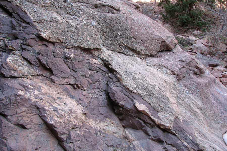
Double the Pleasure
The final event in the Flatirons’ formation was the building of the modern Front Range, which lasted from about 70 to 64 million years ago. The uplift was accomplished along a series of faults whose motion tilted the Fountain Formation layers down to the east, creating the Flatirons’ impressive 50-to-60-degree slopes. In the process of building today’s peaks, one fault north of Baseline Road shoved rocks from the west up and over rocks to the east. Farther south, a different fault, which cuts right through the Flatirons, shoved layers from the east up and over rocks farther west. Thanks to the eastward tilt of the rock layers, this east-over-west fault geometry stacked up a double thickness of the Fountain Formation on Green Mountain and Bear Peak—a bit of geologic serendipity that, along with the exceptionally strong cement, has made it much more difficult for Mother Nature to quarry and remove the Fountain Formation in this area, resulting in Boulder’s iconic backdrop.Lon Abbott grew up in Boulder and is now a geology professor at the University of Colorado. He and his wife, Terri Cook, authored Geology Underfoot Along Colorado’s Front Range. He often gives talks about the local geology; see www.down2earthscience.com for upcoming events.