Miles of Adventure
05 Aug 2024
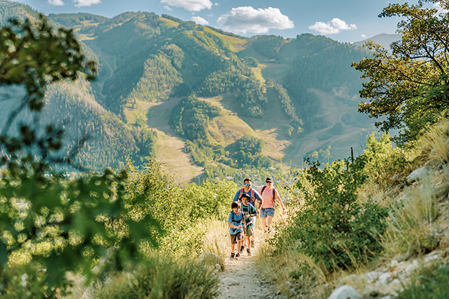
Explore mountains, lakes and rivers on Colorado’s scenic byways
Words and photos by Matt Maenpaa
What words are there to describe the beauty of Colorado that haven’t already been written? From the sprawling, windswept beauty of the eastern plains to the lush pine forests and snow-capped mountains, red rock canyons and stark deserts, this state really has everything. The real trick is figuring out how to see it all in just a lifetime.
Fortunately, woven through interstates, state highways and country roads, Colorado’s scenic byways provide jaw dropping vistas and easy ways to explore all our fair state has to offer. There are 26 designated scenic byways in the state of Colorado, selected for their natural beauty, recreational opportunities and historical significance, among other criteria.
Some byways require trekking out to the far reaches of the state, like Grand Mesa or Trail of the Ancients, but many are just a few short hours from Boulder County. Whether you’re looking for a single day adventure or a weekend excursion to show visitors the sights, these byway loops will take you through some of the finest locales in the heart of Colorado.
Peak to Peak
Starting off close to home with Colorado’s oldest scenic byway, designated in 1918, the Peak to Peak links Blackhawk and Estes Park via Colorado Highways 7 and 72. More gentle curves than wheel-gripping hairpins in most places, the byway offers gorgeous views of the Continental Divide as it skirts the boundaries of the Front Range.
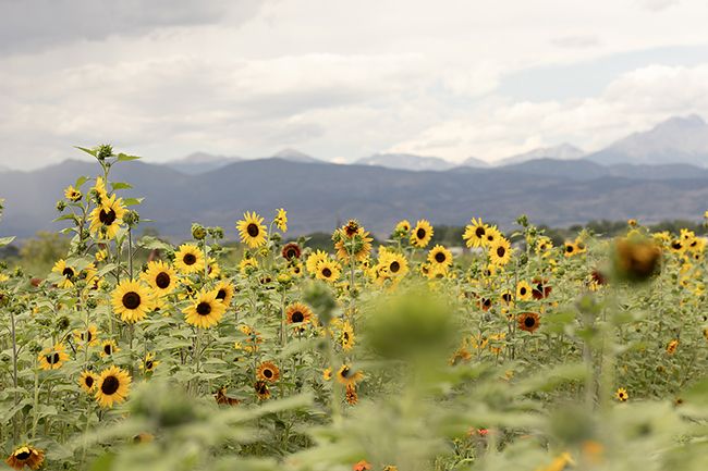
Escape the dusty reds of the Front Range to cruise through pine forests and alpine meadows bursting with wildflowers in the spring. Aspens rustle in the breeze, lighting the byway with flares of color in autumn. Ghost towns at Hesse and preserved settlements at Caribou Ranch highlight the rich history at our fingertips, ready to be explored by the brave and seasonally prepared. St. Catherine’s Chapel at Camp St. Malo overlooks the highway near Allenspark as well, a must-see for any visitor.
Peak to Peak is ideal for a day trip out to Boulder’s neighboring mountain towns and quick getaways, or as a scenic launching point to more adventurous itineraries.
The Lariat Loop
Another ideal day trip from Boulder, the Lariat Loop follows Colorado Highway 74 as it weaves through Morrison, Golden and Evergreen. Snake up the canyon from Morrison to get a coffee in the town of Kittredge or go just a little further to spend the day exploring art galleries and shops in Evergreen.
Aspiring paleontologists and geologists can stop at Dinosaur Ridge to follow tracks along parts of the “Dinosaur Freeway” and scope out fossils from prehistoric giants in the visitors’ center. From there, venture up Lookout Mountain to take in gorgeous views of the Front Range. Clear days and the right vantage point along the road offer perfect views of Denver to the east and peeks at peaks to the west.
Atop Lookout Mountain, the nature center and preserve make for a beautiful picnic spot and Boettcher Mansion highlights the history of local industry and conservation. Winding back down toward Golden, the final resting place of Buffalo Bill Cody is a must for Wild West enthusiasts, and the museum there holds artifacts from the storied past and indigenous history.
Trail Ridge Road, Rocky Mountain National Park, the Colorado River Headwaters and Cache la Poudre/North Park
Looking for a little more adventure and a multi-day experience? Best get an early start on the day, because Rocky Mountain National Park, or RMNP, awaits. Arguably the crown jewel of Colorado’s national parks and one of the most popular places in the country, RMNP is a must-see for locals and tourists alike.
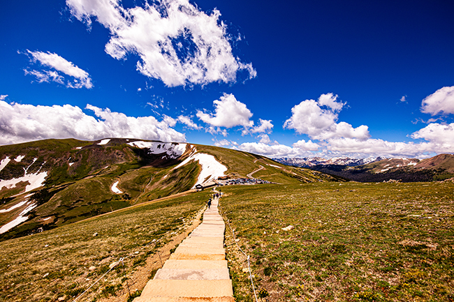
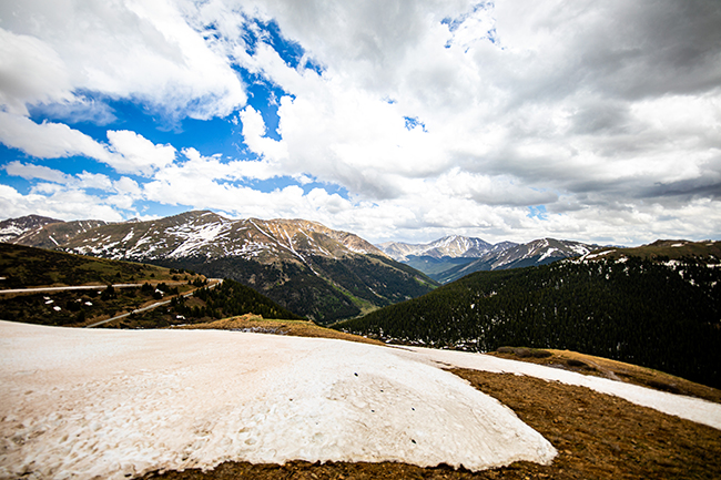
One could spend years in RMNP exploring the trails and hidden lakes, taking in craggy peaks and reaching their summits, but Trail Ridge Road affords visitors an opportunity to see the expanse of the park from well above the tree line, weather permitting of course. Climbing to more than 12,000 feet in altitude, the views are quite literally breathtaking.
Instead of returning to the eastern side of the park though, keep going west across the Continental Divide to descend into Grand County, where lakes await. Coming out of RMNP, the Colorado River Headwaters scenic byway starts at Grand Lake and continues west all the way out to State Bridge, as the tumbledown mountain creek eventually gains tributaries and begins to expand into the vital waterway that irrigates the American West.
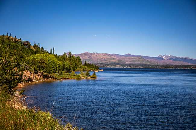
Spend a night in Granby, exploring Lake Granby’s 40 miles of shoreline and the third-largest body of water in Colorado. White pelicans fish the reservoir right alongside sails and speedboats, while moose and elk roam the shores. Instead of venturing west along the Colorado River, turn north up the high plains until you reach the town of Walden, where you can then veer east to pick up the Cache la Poudre/North Park byway.
Crossing back over the Continental Divide, follow the river through wide, placid bends ready for fly fishing and deep forests hiding more lakes and campgrounds. The closer the byway gets to the Front Range, the tighter the rocks get. Canyon walls loom and narrow into gorges, while alpine forests eventually give way to sandstone as the byway lets out in Fort Collins.
Guanella Pass, Collegiate Peaks and the Top of the Rockies
Finally, but far from least, this three-day journey travels over multiple high elevation passes, through the thickest density of 14,000-foot peaks in the state and visits plenty of charming mountain hamlets. Starting off on I-70, escape the constant traffic of the mountain interstate at either Downieville or Georgetown, cutting south along backroads and climb the steep and narrow roads past clear waters and aspen groves to reach the heights of Guanella Pass.
Venturing south down the pass connects with Highway 285, continuing through Fairplay and unbelievable landscapes until you reach Chaffee County and the Arkansas River Valley. Nearby towns of Buena Vista and Salida offer recreation and relaxation, while a bounty of hot springs provide steamy soaks in the geothermally heated mineral waters. The Collegiate Peaks loom over the valley, and the byway stretches along Highway 24 north and south.
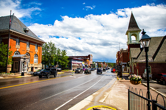
Following the road north, the Collegiate Peaks byway yields to the Top of the Rockies. From there, the roads branch. The western leg climbs up Independence Pass, eventually reaching Aspen. Pass by the remnants of the ghost town of Independence on your way, imagining life in earlier days. Alternatively, voyage further north through the town of Leadville, cruising past Mt. Massive and Mt. Elbert. What was once the capital of mining in Colorado is now a quaint historic destination. Be sure to time your visit for the annual burro races during Boom Days at the start of August.
North of Leadville, the byway branches, ending up in either Minturn or Silverthorne, with the slopes of Dillon, Frisco and Breckenridge beckoning. Getting back to Boulder is an easy drive back down I-70 via the Eisenhower Tunnel.
Regardless of your eventual destination, be sure to check the weather forecast and access points. Locations like RMNP still require timed entry during peak season, and many passes like Independence, Guanella and Trail Ridge Road close in the fall when conditions get dangerous. Likewise, adventuring along canyons and waterways like the Cache la Poudre and Arkansas River risk flash floods.
More information on scenic byways can be found through the Colorado Department of Transportation (codot.gov), including maps and weather guides. Plan your routes with COtrip.org to get the latest road conditions and mark your routes using MyScenicDrive.com.