Along the River’s Edge
01 Apr 2026
The precarious tale of the Colorado River
Words and photos by Matt Maenpaa
Humanity’s progress has been shaped by rivers, from the Tigris to the Euphrates to the Mississippi. When telling the story of the American West, with its rugged mountains and dramatic deserts, following the rivers becomes crucial to understanding how the land and the people have been shaped and what our future holds.
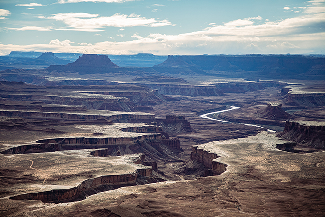
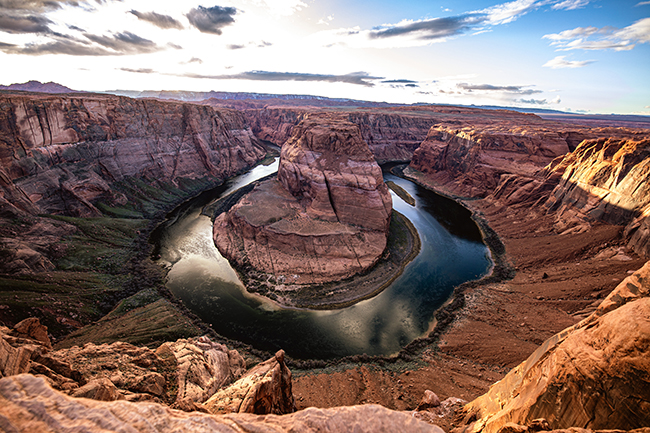
The Colorado River stretches 1,450 miles, starting in the Rocky Mountains and spilling down the divide, cutting through Colorado’s western slope, through Utah, Arizona, Nevada, and California. Tributaries like the Green and San Juan rivers flow from Wyoming and New Mexico respectively, joining the Colorado on its journey westward, eventually crossing into Mexico and spilling out into the Sea of Cortez. Over millions of years and through erosion, the Colorado River and its tributaries have carved breathtaking canyons from sandstone and granite—lands that now draw millions of visitors eager to take in the spectacle of these unique landscapes.
As Americans began their great expansion into the West, chasing gold, minerals, and the dreams of a new life, they followed the water. As mining began in the mid-1800s, the rule of prior appropriation came to govern claims on land and its resources, including the water. Regardless of how far a land claim was from the source, whoever got there first got the water. On a grander scale, that applied to the entire Colorado River and the state of California, which Basin States and territories feared would establish priority rights under prior appropriation.
By the early 1900s, the seven states in the Colorado River Basin recognized a need to come together and find a more equitable solution for sharing the water. Each state had growth in mind, further complicated by industrial stakeholders, obligations to Tribal Nations, and to Mexico at the river delta. In 1922, led by Secretary of Commerce Herbert Hoover, the Colorado River Compact was signed, and Congress approved it through the Boulder Canyon Project Act in 1928 as a six-state compact because Arizona did not ratify until 1944. The elaborate agreement codified “the Law of the River,” dividing the river and apportioning water to each.
The Colorado River Basin was divided into the upper—Colorado, Wyoming, Utah, and New Mexico—and lower—Arizona, Nevada, and California—marked by a place called Lees Ferry near what is now Glen Canyon Dam and Lake Powell. Negotiators based their estimates of the river’s capacity on hydrologists’ reports that at least 17 million acre-feet, roughly 5.5 trillion gallons, of water flowed from the headwaters to the delta each year. Each Basin was given 7.5 million acre-feet per year to allocate among its states according to percentages. Additionally, further actions created water appropriations for Mexico and the Tribal Nations of the Southwest.
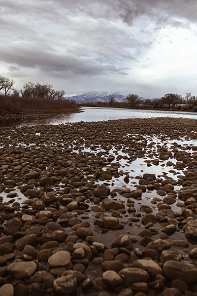
The compact negotiators relied on overly optimistic river flow estimates and didn’t anticipate the expansive urbanization in the West or the effects of climate change and aridification in the desert. As of 2000, the Basin has seen one of the worst multi-decade droughts in the last 1,200 years. Over the last 20 years, annual flows have been in decline and well below average, threatening the infrastructure built to harness the river for agriculture, industry, and recreation.
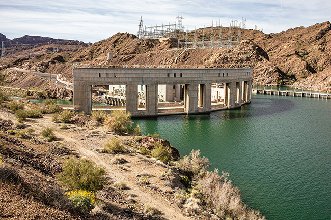
Prompted by Lower Basin agriculture arguing for better flood control, planning of the Hoover Dam began not long after the Compact was signed. The marvel of engineering was completed in 1936, impounding the Colorado River in Lake Mead. In 1957, construction of the Glen Canyon Dam started to match the hydroelectric power and water storage of the Hoover Dam, leading to the formation of Lake Powell. At their full capacities, together these massive reservoirs can hold 50 million acre-feet, about three years’ worth of the river at its highest capacity. Overdrawing from the Lower Basin, along with droughts, has reduced the reservoirs to fewer than 15 million acre-feet total.
The Basin includes nine primary national park system units, including Rocky Mountain National Park and Black Canyon of the Gunnison, along with thousands of square miles of land held in public trust by the Department of the Interior, through the U.S. Bureau of Reclamation and the Bureau of Land Management, as well as the U.S. Forest Service. The entire Basin, including seven states, 30 Tribal Nations, and two countries, spans 246,000 square miles and serves more than 40 million people.
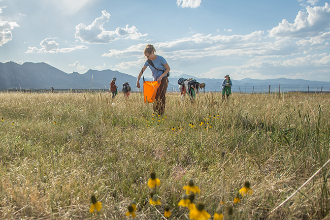
The vast land is crucial for farms and industry, as well as for the recreational tourism it provides. Amid myriad stakeholders and the environmental needs of fragile and critical ecosystems, maintaining the balance of the river is a complicated undertaking. The years are becoming drier everywhere, with Colorado experiencing near-record-low snowpack across many areas in 2026. According to observations from the National Oceanic and Atmospheric Administration, temperatures from November 2025 through January of 2026 were higher than normal, and with significantly less precipitation.
Less snowpack in the mountains means less water headed downstream, and less water to fill diminishing reserves in Powell and Mead. Lake Powell is estimated to have lost 30 feet of depth over the last couple of years, and is predicted to lose more, ultimately threatening power generation at Glen Canyon Dam if levels are too low. To maintain water levels and ensure fair access, interim guidelines were adopted in 2007 to update river data and establish new allocations. When reservoirs dropped to critical levels in 2022, severe limitations were imposed on how much water could be withdrawn from Powell and Mead to preserve the integrity of the hydroelectric dams.
The temporary rules are set to expire at the end of 2026, as the Basin States continue to seek an agreement. To help manage the critical resource, the U.S. Department of the Interior issued a draft environmental protection plan for use in the interim until the states reach a new agreement. The multi-volume Draft Environmental Impact Statement maintains that the 2007 rules weren’t robust enough to manage the river system and takes a stricter approach to anticipate worsening drought conditions over the next two decades. Shortages could be imposed on both the Upper and Lower states—depending on reservoir conditions—to keep the dams operating. While the Lower Basin may need to reduce drawdown, the Upper Basin may need to slow diversion or release portions of its reservoirs. The goal is to create a functional guideline that can maintain the health of the waterways and address the needs of all parties.
“Negotiation efforts have been productive; we have listened to every state’s perspective and have narrowed the discussion by identifying key elements and issues necessary for an agreement. We believe that a fair compromise with shared responsibility remains within reach,” Secretary of the Interior Doug Burgum said in a news release. “I want to thank the governors of the seven Basin States for their constructive engagement and commitment to collaboration. We remain dedicated to working with them and their representatives to identify shared solutions and reduce litigation risk. Additionally, we will continue consultations with Tribal Nations and coordinate with Mexico to ensure we are prepared for Water Year 2027.”
There would be no American West without the Colorado River, and even Colorado’s Front Range would struggle without those reserves. The tenuous threads that bind our lands together need to be protected so that there can still be a future for all of the people who rely on these waters.